Pro GPR Surveys
GPR Surveys That Find What Matters
Get a Free Quote From Us Today!
We aim to get back to you in 24 hours.
At Pro GPR Surveys, we provide advanced ground penetrating radar (GPR) surveying services designed to detect and map subsurface features with precision across the UK. By utilising electromagnetic pulses, pro GPR surveys ensure that site teams have a clear understanding of underground conditions, resulting in safer project planning and the prevention of catastrophic utility strikes.
By managing the technical complexities of the subterranean environment, this service preserves the structural integrity of your site and ensures your groundwork is founded on verifiable data.
What Services Are Included In Pro GPR Surveys?
A comprehensive package when commissioning pro GPR surveys includes several technical stages to ensure total subsurface transparency:
- Site Reconnaissance – Evaluating surface conditions and material density to calibrate instrumentation for optimal signal resolution.
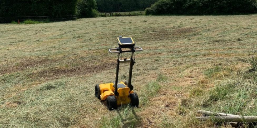
- Radar Scanning – Deploying non-invasive antennas across a structured grid to capture real-time reflections from buried assets.
- Data Interpretation – Analysing complex hyperbolic signal returns by expert geophysicists to differentiate between soil and objects.
- Utility Mapping – Tracing the route and depth of metallic and non-metallic conduits to prevent accidental damage.
- Digital CAD Production – Converting raw signal data into layered drawings that integrate with architectural site plans.
Why Should You Choose Professional Pro GPR Surveys Services?
Choosing professional pro GPR surveys ensures that your project is supported by expert data interpretation and the latest multi-frequency radar technology. Professionals can distinguish between complex signals, identifying subtle threats that non-specialist operators might overlook.
This expert oversight maximises site safety, providing a clear audit trail and protecting your organisation from the catastrophic consequences of striking high-pressure gas mains.
How Much Do Pro GPR Surveys Cost?
The total professional fee for pro GPR surveys ranges from £850 to over £12,000 per project, depending on the acreage to be scanned, the density of the search grid, and the depth of penetration required.
Pricing is heavily influenced by the technical complexity of the terrain, the need for multi-frequency antennae to detect both deep and shallow objects, and the time required for meticulous data post-processing and CAD drafting.
Contact Pro GPR Surveys to get customised prices for ground penetrating radar surveying at your property.
Get a Free No Obligation Quotation Today
Where Are Pro GPR Surveys Required Across Projects?
Specialist work managed by pro GPR surveys is required across a diverse range of environments, including active highway corridors, rail environments, and high-density urban construction plots. The service is critical for brownfield redevelopment, where records of buried assets are often missing or unreliable.
By mapping these environments, the team identifies unknown hazards, ensuring that safety compliance targets are met while preserving the continuity of essential local services.
When Should You Carry Out Pro GPR Surveys?
You should carry out pro GPR surveys during the early feasibility or pre-design phase of a project, well before any drilling, piling, or excavation activities commence. Early scanning helps identify hidden subsurface risks such as sinkholes, old foundations, or high-voltage cables that could stall your project timeline.
Engaging our team at this stage ensures your site risk assessments are based on real-world data, which prevents expensive project delays.
How Does The Pro GPR Surveys Process Work?
The technical workflow for pro GPR surveys involves a sequence of surface scanning, signal recording, and meticulous data analysis to guarantee geospatial integrity. We move radar antennas across a structured grid to capture electromagnetic reflections, which are then filtered to remove background noise.
This methodology ensures every subsurface anomaly is logged with absolute accuracy, providing your engineering team with the technical clarity required for complex groundworks and foundation design.
What Can Be Detected Using Pro GPR Surveys?
A wide variety of features can be identified through pro GPR surveys to provide a complete picture of the subterranean environment:
- Underground Utilities – Identifying the location and depth of plastic pipes, fibre optic cables, and conduits.
- Voids and Cavities – Detecting hidden ground instabilities or washouts that could lead to structural failure.
- Reinforced Concrete Elements – Locating rebar and post-tension cables within slabs to ensure safe core drilling.
- Buried Foundations – Mapping the extent of old basement walls, tanks, and ruins that obstruct new piling.
- Geological Anomalies – Identifying changes in soil strata or water table levels to assist geotechnical assessments.
Request a free quote
Which Industries And Projects Benefit From Pro GPR Surveys?
Many professional sectors utilise pro GPR surveys to manage the safety and financial risks of their physical developments:
- Civil Engineering Firms – Requiring precise utility mapping to design safe and compliant highways and subterranean infrastructure.
- Property Development Groups – Using radar data to verify land suitability and avoid the costs of unknown obstructions.
- Utility Providers – Needing accurate asset location to minimise service disruption during network maintenance or connections.
- Archaeological Consultants – Detecting buried structures non-invasively to preserve historic integrity while assessing development potential.
- Local Government Authorities – Commissioning highway surveys to prevent accidents and manage the long-term integrity of public roads.
How Quickly Can Pro GPR Surveys Be Completed?
Most field operations for pro GPR surveys can be completed within one to three working days, depending on the total surface area and the density of the survey grid. Once the data capture is finished, the computational analysis phase takes approximately forty-eight hours to convert raw signals into readable maps.
This efficiency ensures your project schedule is not delayed, providing your team with the high-resolution subsurface records needed to move forward with groundworks immediately.
What Safety Standards And Regulations Apply To Pro GPR Surveys?
All professional work conducted by pro GPR surveys follows the PAS 128:2014 standard for underground utility detection and mapping to ensure technical rigour. This ensures that the methodology used is technically defensible and that the resulting data is reliable for engineering and design purposes.
Following these codes provides the insurance-backed certainty that developers demand, protecting the financial and physical safety of your construction or infrastructure investment.
Contact Pro GPR Surveys for a consultation to get ground penetrating radar surveying tailored to your organisation’s risks and responsibilities.
speak with our team today
What People are Saying About Us
★★★★★
"Excellent GPR survey service with clear reporting and outstanding attention to detail. The team were professional and easy to deal with throughout."
Henry Matthews
London
★★★★★
"The survey was completed efficiently and the final utility mapping information was extremely accurate and professionally presented."
Rachel Atkinson
London
★★★★★
"Great communication from start to finish and very fast delivery of the survey results. The whole process was straightforward and stress free."
Ross Jenkins
London
★★★★★
"Highly impressed with the professionalism shown on site and the quality of the final survey package provided for our project."
Jessica Holland
London
Our Locations
We are proud to work nationally across the UK, allowing us to ensure we can provide services to you.
For a full list of counties we cover in the UK, see below.